Servicing Geelong, Melbourne, Torquay, Warrnambool and surrounding areas
With a team of licenced surveyors and industry experts, we provide precise and dependable land development consulting covering a broad range of services such as subdivisions, boundary surveys, application surveys, drone survey and scanning, asset recording and underground utility location services, and construction and engineering surveys. Our extensive knowledge and locations in Geelong, Melbourne, Torquay and Warrnambool make us the trusted choice for all your land development needs.
Discover our full list of services below.
Expert guidance and solutions for all types of Subdivision projects
Our Licensed Surveyors have decades of experience overseeing every stage of the subdivision process, from planning, through to certification and compliance, they will ensure a smooth and efficient transition.
Our subdivision services:
- Low – Medium Density
- Building Subdivisions
- Estate Subdivisions
- Boundary Realignment
- Subdivision Permit Support
Accurate, compliant, and reliable Boundary (Cadastral) Surveys
A Boundary Survey, also known as a Cadastral Survey, is a legally binding and accurate survey of your property’s title boundaries.
Our boundary survey services:
- Title Re-establishment Survey
- Title Survey
- Desktop Survey
Simplify the process of combining multiple land parcels into one with our Land Consolidation applications
Our land consolidation applications are designed to simplify the process by combining multiple parcels of land into a single, consolidated parcel. Our Licensed Surveyors can assess if a survey is needed and prepare the required documents for submission to the local council for approval.
Application Surveys for Land Use Victoria
We provide comprehensive surveying services to support all land-related applications submitted to Land Use Victoria. Ensuring that developments are designed and constructed within the legal title boundaries is a requirement in Victoria. In cases where title boundaries are unclear or disputed, compliance may require a title amendment or an adverse possession claim.
Our application survey services:
- Adverse Possession
- Title Amendment
- Title Conversion
Understanding the impact of encumbrances on ownership and development
Encumbrances are legal rights or restrictions that affect a property’s title. These include easements (rights for third parties to use part of the land) and restrictive covenants (limitations on how the land can be used or developed). Encumbrances can impact property value, development potential, and the ability to sell or transfer ownership, so it’s important for property owners to be aware of them.
Our encumbrances services:
- Easement Removals & Creations
- Restrictions
Lease Plans that meet legal and regulatory requirements
We provide comprehensive lease and licence survey services to support property agreements across various industries. Our lease plans accurately define leased areas, ensuring compliance with legal and regulatory requirements. Whether for commercial, industrial, or government agreements, we deliver precise and reliable survey documentation.
Our lease plan services:
- Authority Lease Plans
- Net Lettable Area (NLA) Surveys
- Gross Lettable Area (GLA) Surveys
Navigating Town Planning with confidence and clarity
Smith Land Consulting assists our clients with their town planning requirements, guiding their projects from inception to completion. We work with a team of experts to find tailored solutions, ensuring your subdivision project meets all regulatory standards and progresses smoothly. Our goal is to help you navigate the planning process efficiently, getting your project up and running with the right approvals in place.
Our town planning services:
- Planning Reports
- Supporting Documentation
- Urban Design (PSP Plans)
- Subdivision Design & Feasibility
- Pre-Application
Tailored Government and Service Authority Surveys for planning and development
We provide professional surveying services to government and service authorities, supporting the planning, development, and maintenance of public infrastructure. Our team has extensive experience conducting surveys that meet all regulatory and compliance requirements, ensuring accuracy and reliability in every project.
Our government & services authority survey services:
- Road Discontinuance
- Land Acquisition
- Infrastructure Surveys
- Crown Land Surveys
Cutting-edge Drone Survey & Scanning for enhanced project accuracy
As technology evolves, so do the methods we use to capture precise survey data. At Smith Land Consulting, we specialise in aerial and terrestrial scanning, providing highly accurate data for large-scale land surveys and detailed 3D modelling of built environments.
Our drone survey & scanning services:
- Drone Survey
- 3D Laser Scanning
Comprehensive Feature Surveys for informed planning and development
Feature surveys provide detailed information about the natural and built characteristics of a site, essential for planning, design, and development. These surveys capture critical data such as ground levels, existing structures, vegetation, utilities, and other site features.
Our feature survey services:
- Feature and Level Survey
- Rescode Survey
- Australian Height Datum Surveys
- Floor plan Survey
- Hydrographic Surveys
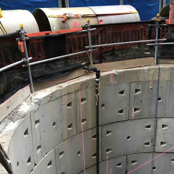
Supporting construction and engineering with Set-Out, As-Built, and Volumetric Surveys
We support the construction and engineering industries with accurate and reliable surveying services, including Set-Out, As-Built, and Volumetric Surveys. Our expert team ensures that your projects are built to precise specifications, with comprehensive data that supports each stage of construction and engineering development.
Our construction & engineering services:
- Set-out Survey
- As-built and Monitoring
- Volumetric Surveys
Accurate mapping for infrastructure compliance and handover
Our asset recording services support developers, engineers, planners and authorities with detailed mapping and documentation of newly constructed assets. We deliver A-SPEC compliant data ready for council submission, ensuring smooth infrastructure handovers and reliable asset management. Using the latest survey methods and software, we help clients meet regulatory standards and streamline project delivery.
Our asset recording services include:
- A-SPEC compliant surveys
- Infrastructure asset mapping
- Barwon Water handover documentation
- Council-specific data formatting
Safe, efficient detection of subsurface infrastructure
We provide accurate underground utility location services to reduce risk and support confident planning. Our experienced team uses advanced cable locators and non-invasive techniques to detect, map and report on underground services including cables, pipes, and telecommunications. These surveys help avoid service strikes and delays during construction, while providing vital data for planning and design teams.
Our underground location services include:
- Underground service location
- Cable and pipe detection
- Utility mapping and reporting
- Pre-construction site investigations
Our licensed land surveyors and development consultants bring extensive expertise to every project, delivering precise boundary re-establishments, detailed feature surveys, and comprehensive subdivision consulting. Supported by a dedicated team, we provide end-to-end service, from initial planning and surveying to project management and ongoing support, ensuring successful outcomes across residential, commercial, and industrial developments.